3D Mapping Drone Gurgaon

  Other Services

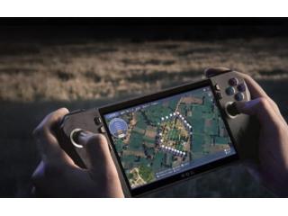
Asteria Aerospace’s 3D mapping drone is an advanced solution for creating highly accurate three-dimensional models of landscapes and structures. This drone is equipped with state-of-the-art sensors that capture detailed spatial data, which is then transformed into precise 3D maps. Whether you're in construction, mining, or environmental monitoring, Asteria Aerospace’s 3D mapping drone offers unmatched precision, efficiency, and real-time results to help you visualize and analyze terrain with ease.


 Published date:

May 29, 2025

 Region:

Haryana

 City:

Gurgaon

 Views

3


Share by email Share on Facebook Share on Twitter Share on Google+ Share on LinkedIn Pin on Pinterest

Useful information

  • Avoid scams by acting locally or paying with PayPal
  • Never pay with Western Union, Moneygram or other anonymous payment services
  • Don't buy or sell outside of your country. Don't accept cashier cheques from outside your country
  • This site is never involved in any transaction, and does not handle payments, shipping, guarantee transactions, provide escrow services, or offer "buyer protection" or "seller certification"

 User

Contact publisher


    Related Ads

    No Related Ads