Other Services
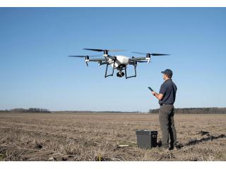
Unlock the potential of your projects with our expert drone surveying and mapping services! At Aeroyantra Technologies Private Limited, we utilize cutting-edge drone technology to provide accurate and efficient land assessments, topographical mapping, and aerial photography. Whether you’re in construction, agriculture, or real estate, our drone surveying and mapping solutions can save you time and money while delivering high-resolution data and detailed insights. Don’t settle for less – elevate your projects with precision.


